Showing posts with label Gold Butte. Show all posts

Friday, April 27, 2018

Virgin Peak


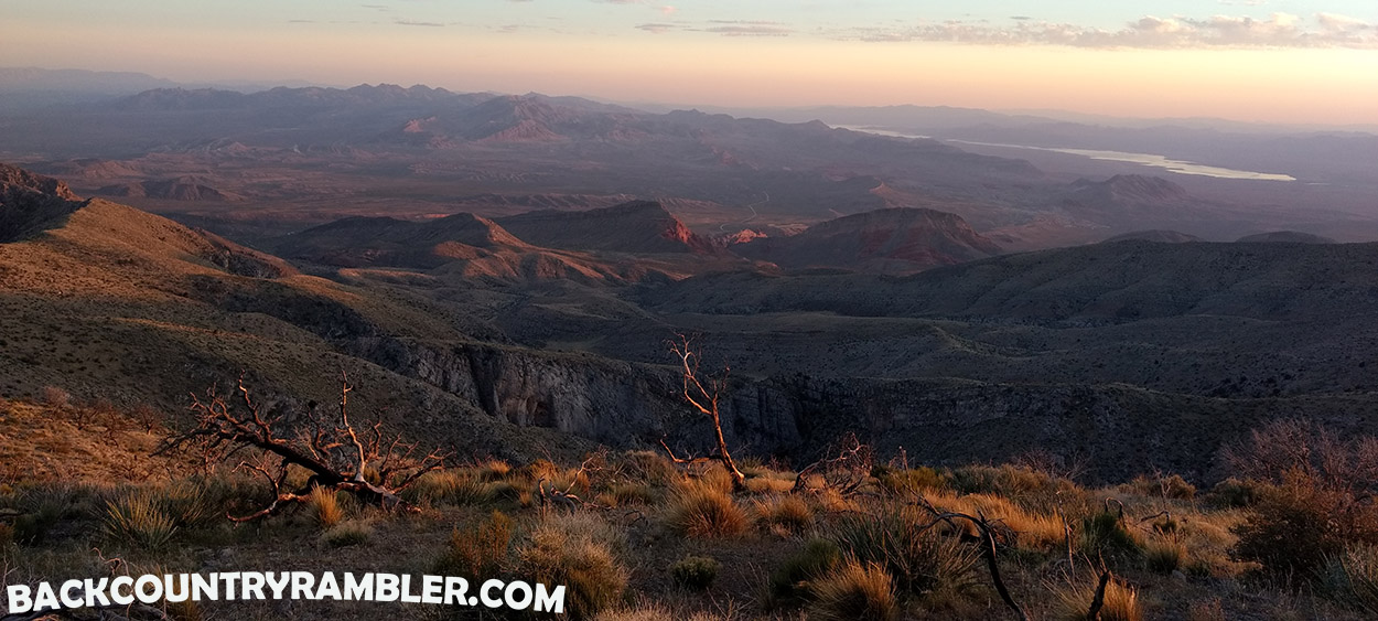
The sun set and the sun rise over Gold Butte from Virgin Peak

One of the greatest things about the Gold Butte country is that it offers a wide array of geographic features and environments. You can explore red sandstone cliffs and canyons, access the Colorado river down through Hells Kitchen, explore old copper mines or head up Virgin Mountain and be in the pine trees.


I have spent a lot of time on Virgin Mountain growing up. I love jumping on the wheelers, heading up through Nickel Creek, driving up the mountain and exploring mines and relaxing while drinking from Wire Grass Spring. I have hiked quite a bit on the mountain as well but have never hiked to Virgin Peak…until now.


Virgin Peak sits at 8,087 and is the highest peak on the Virgin Mountain Range, (growing up I always called Bunkerville Mountain but maybe that's just us Logandale folk?). To hike the Virgin Peak the best route, if not the only route, is from the south side, base camping near Whitney Pockets. From the Corral at Lower Camp to the Peak the hike is 5.38 miles. I wanted to hike the entire ridge so I took a little different route but next time I will hike up through the canyon a ways and then hit the ridge a little higher up as shown on the map below in blue. The route I went was pretty rough and there were a few parts that were a little sketchy. I don’t recommend taking the yellow line on the map below.

I did took the Yellow line but next time I would take the Blue line through the Canyon


 This little section across the hogs back was a little sketchy

This is where I started my hike from. If you look just above the .com part there is a chucker or sage hen


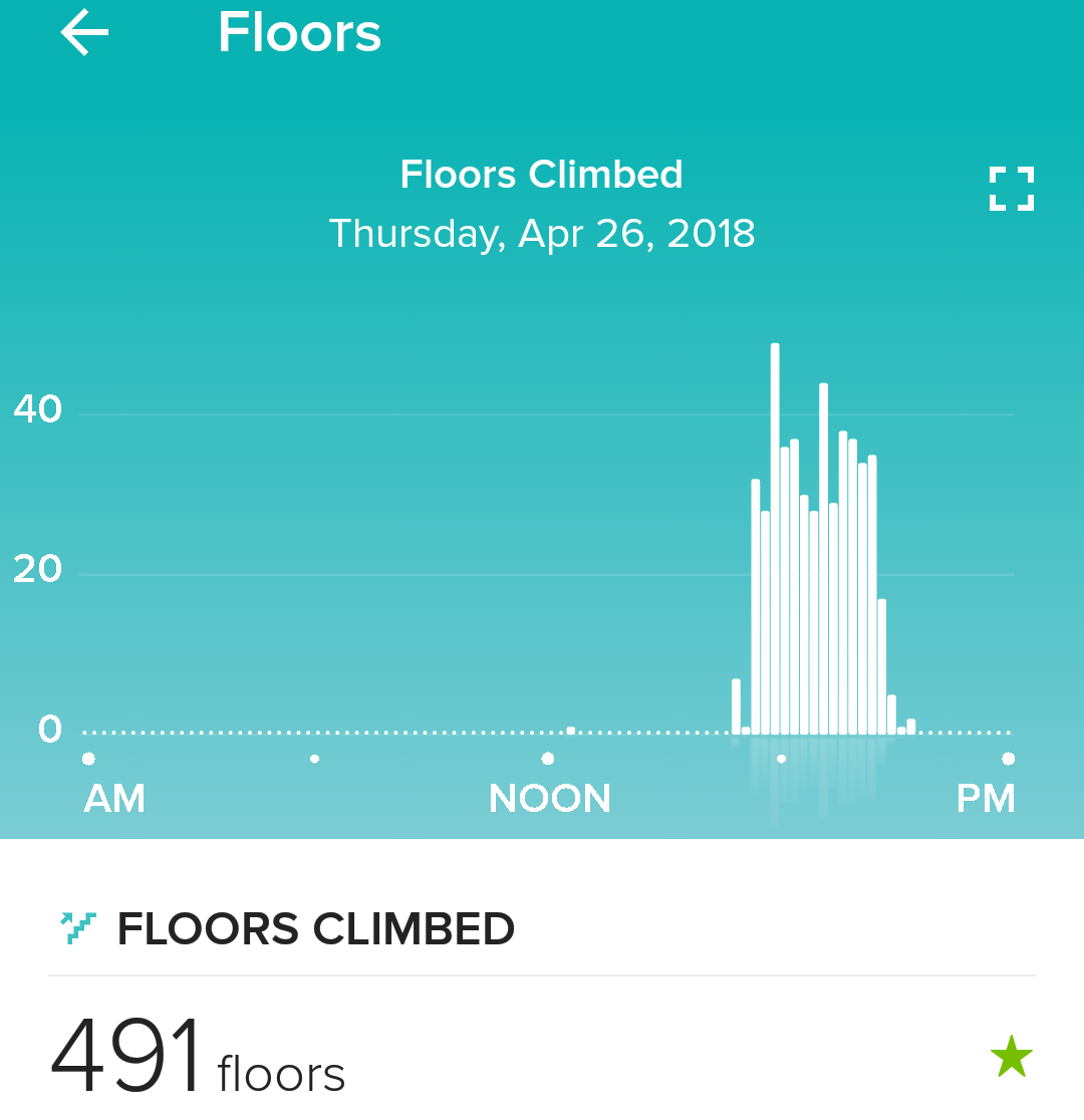
I was able to do the hike in 3 hours but the last 45 minutes was in the dark with a headlamp so I think you could do it a little faster if you wanted. If you want to train for this hike go run 491 flights of stairs.


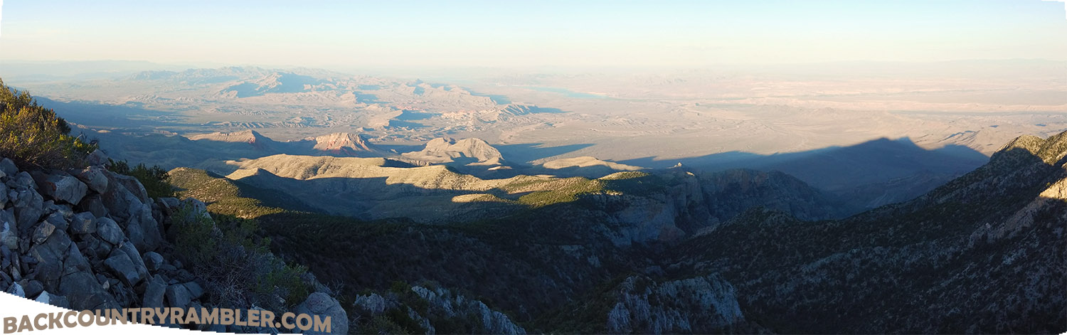
The hike was most excellent. The Birds eye view it offers of the Gold Butte country is amazing. For anyone who is familiar with the surrounding areas of Moapa Valley and Virgin Valley it offers a great vantage point of these areas as well. On a somewhat clear day you can even see the lights of Las Vegas and Henderson.


I had a hard time narrowing down my favorite pictures so here are quite a few of them on the way up to the Virgin Peak.


My plan was to come down to the east and hit the Virgin Range Peak but getting off Virgin Peak to the east was treacherous at best and I was hammered by the time I hit the saddle between the peaks so I just ended up going down Upper Camp Canyon. It would be my advice to get off the peak the same way you came up. 


I made camp right at 8,000 feet. It was a little rocky but to camp on the peak and watch the sun come up was worth it.


my pack list:


tent
sleeping bag
lighter
paracord

watch cord
battery pack

light
book
toilet paper

extra socks
long sleeve shirt
tank top

8 oz jerky
laura bar
pop tarts
90 oz water
gum

for the truck:
ice chest
frozen water bottles

Note: pack weighed in at 27.4 lbs
next time I will take half the food and an extra liter of water


Wednesday, December 7, 2016

Kohta Circus Petroglyphs

Kohta Circus Petroglyphs

The cultural landscape of the Whitney Pockets area is as rich and colorful as the sandstones that break from the desert floor at the landing of Virgin Mountains. It is within these sandstone outcroppings where some of the first known inhabitants recorded their story in rock carvings known as petroglyphs.


The Luke Whitney Petroglyphs which include Falling Man are some of the most accessible petroglyphs in the Gold Butte region. Just a short distance off the old Gold Butte Road, down a rough and rocky road one can be surrounded by the carvings etched upon the red sandstone canvas. For the back country rambler who is willing to lace up their boots and wade farther back into the sea of sandstone, there holds even more portrayals from prehistoric people. Hidden within an arroyo at the head of Hartman Tank is the petroglyph site known as Kohta Circus is.


To find the Kohta Circus Petroglyphs first go to the Luke Whitney Petroglyphs also known as Falling Man. Once you get to the trailhead of Falling Man you will see a road that heads to the west continuing on down towards Black Butte and Bitter Ridge. You continue on down this road for about two miles. This road is not maintained in any fashion however most high clearance vehicles, with an experienced driver at the wheel, should be able to pass without the need for four-wheel drive. As you start to head more south and start to round Black Butte you will see a trailhead off the east side of the road as the road starts to climb up out of the wash and onto Bitter Ridge. The trailhead is for the Kohta Circus Petroglyphs hike.


Once you get to the trailhead it’s hiking from here on out. Leaving the trailhead you will get into the nearby wash and head in a southerly and slight easterly direction. The trail at this point is quite defined. You are only in the wash for about a quarter of a mile or so. Once out of the wash the trail heads in a steady southern course for approximately 1.5 miles.  The trail is pretty well defined and is fairly easy to follow for the experienced back country rambler. The only place where it is hard to follow is when the trail crosses over the sandstone outcroppings but at these locations previous hikers have stacked cairns to mark the trail. The trail to Kohta Circus Petroglyphs is a mixture of walking in the rocky wash bottoms, patches of sand as well as crossing sandstone outcroppings.


Once you get near the Kohta Circus Petroglyphs site you will dump off the plateau into a drainage basin that is the beginning of the Hartman Tank which eventually dumps into Mud Wash. There is a defined trail leading down into the basin area.


The main petroglyph panel is one of the larger continuous panels that I have seen in Clark County, Nevada. I have heard that they call it the Circus panel because of all the depictions of animals. There are carvings of sheep, deer, turtles and many kinds of tracks and things I could only guess at.  One of my favorite etchings is of a man hunting a sheep with his bow as well as a pretty healthy looking deer.


I love the desert as it requires one to appreciate the innate power of nature that has shaped this rugged landscape. As I start down a simple sandy wash and walk down a growing chasm carved into the desert floor, countless centuries of work unfold before my eyes.  The rising walls about me stand as evidence of the epic floods that have carved their story into hills and valleys. One cannot help but to marvel at the smooth pathways worn into the stone on a typically dry desert day and help but to imagine the individual drops of each storm that has passed to weary these rocks into submission. Within these desert canyon walls time eludes all logic.


The few small slot canyons found within the vicinity of the Kohta Circus petroglyphs aren’t huge but are a great complement to the back country ramble.  The chance to be immersed in the churn of colors unearthed within Mother Nature palate is well worth the effort. 


One thing to keep in mind when visiting Kohta Circus Petroglyphs or any back country destinations within the Gold Butte region is the time of the year to visit. The temperatures in the desert here regularly climb over 100 degrees F. in the months of June through September.  The Kohta Circus Petroglyphs are found within a drainage system so if it has been raining or is raining it would be a good idea to get to higher ground. Also the wash that you walk down and cross under Black Butte drains a lot of country so make sure you are able to get back to camp before the water starts flowing down that wash. Don’t cross the wash is there is water running down. A quick thunder burst in the desert can drop a lot of water in a short period of time and you don’t want to get caught in it. Wait for the water to subside before crossing any wash.


When visiting areas of cultural significance please pay extra attention to ensuring this area is well-looked-after. It is up to each of us as individuals to ensure these areas a cleaned up and unharmed. Please don’t write on the rocks anywhere near any petroglyph sites.


Vicinity destinations
Luke Whitney Petroglyphs, Whitney Pockets, Gold Butte Back Country Byway

Friday, January 30, 2015

Devil’s Fire - Little Finland - Red Rock Springs


Devil’s Fire or Red Rock Springs found within the Gold Butte backcountry offers a surprising display of natural and cultural history painted against the vivid backdrop of the Southern Nevada Desert. These elements come together to create a contrasting portrait of color and culture. The seeps and springs that bubble up the precious desert resource sustains wildlife, vegetation and from time to time human existence. These same waters have helped to carve spectacular sandstone formations which conjure up such vivid names as Devil’s Fire, the Hobgoblins, Little Finland and Lone Palm.  The vivid colors found within Red Rock Springs with the vibrant greens of the palm trees set against the bright reds and oranges of the sandstone is enough to get any backcountry rambler heading for the hills.  


Red Rock Springs is a stop along the way of the Gold Butte Backcountry Byway. For specific information and pictures read Backcountry Rambler: Gold Butte Backcountry Byway. Other stops along the way to Red Rock Springs include Luke Whitney Petroglyphs, Whitney Pockets, Devils Throat, Mud Wash Petroglyphs and Keyhole Canyon. Click on any of the above links to find more information about these Backcountry destinations.


To get to Red Rock Springs or Devil’s Fire turn off Riverside Road onto the Gold Butte Road. Continue down the Gold Butte Road for 21 miles until you get to Whitney Pockets. The road is paved to Whitney Pockets albeit rougher than a horny toads back. After Leaving Whitney Pockets you will continue down a dirt road for roughly 7.5 miles. You will then see the turn off to Devils Throat. After leaving Devils Throat you will continue down Mud Wash heading West for about 3.5 miles. You will then hit the Mud Wash Petroglyphs. After you leave Mud Wash Petroglyphs you will continue down Mud Wash until you see an old Cattle Corral. From the corral it is probably easiest to hike from here to get to the sandstone formations, palm trees and spring. You will see where other folks have made the hike over to the spring from this spot. You are just going up and down washes from this point and there is no official designated hiking trail so have good hiking boots and plenty of water. You can continue down the wash and circle back up to the palms but the road is badly washed out and you will need a high clearance vehicle to gain access coming this way.


Red Rock Springs is known by many different names. Some of them that I have heard it called are Devils Fire, Little Finland and The Hobgoblins. This area is also known as Lone Palm and sometime lumped in with Red Bluff Springs.


In the late 1800’s and early 1900’s Mud wash was the main route from the mines and ranches throughout the Gold Butte country to the railroad at the St. Thomas which was a spur off the Los Angles & Salt Lake Railroad. Two of my grandfathers, Stowel Whitney and Albert Frehner, traveled this route with their team and wagon freighting to and from the Grand Gulch Mine and St. Thomas. The route came up out of the Grand Wash, through the St. Thomas Gap, past Devils Throat and down into Mud Wash. This route continued down Mud Wash past Red Bluff Springs and down through the Red Bluff Springs narrows connecting into St. Thomas where the freight was weighed at the Gentry’s place.


Hartman Tank is named after the rancher, George Hartman who ran cattle in the Gold Butte country in the early part of the 20th century. One of his more notable cowboys was Bill Garrett. Things were good in the early part of that century with plenty of rain and determination to make of go of it in this rough desert country. However after a few years of prolonged drought much of the feed dried up and the ranches did too. Most of the cowboys and ranchers moved on but Bill Garrett moved on up to Gold Butte with Art Coleman. For more information about these two good ol boys visit Gold Butte History.


The corral in Mud Wash, acting now only as an identifier for the trailhead to Red Rock Springs, was once a gather point for the Spring and Fall weaning on the Gold Butte grazing allotment. The cowboys would push all the cows in the lower part of Gold Butte Wash and lower Mud Wash to this corral and use it to separate, brand and handle the cattle. The rest in this area were pushed to Gold Butte headquarters or the corral near the turn off to the Grand Wash Bay road known as Mud. My grandfather Don Whitney ran cattle on this allotment in the 1970’s and 1980’s.


The evidence of earlier inhabitants of this area is marked by the many petroglyphs in the general vicinity. Mud wash, Kota circus, Keyhole Canyon, and the Luke Whitney petroglyphs which include the Falling Man, are just some of the petroglyphs in the area.


The fallen fronds of these giant palms offer cover and a home to a variety of birds and small game. They are sustained by both the water and vegetation found against red sandstone cliffs from where the water seeps.


This seeming misplaced oasis in the Gold Butte desert offers the Backcountry rambler and spectacular view of nature and culture in the Southern Nevada Desert. Be sure when visiting Gold Butte that you have good maps, plenty of water, plenty of spare tires and plenty of time to visit all of the backcountry destinations within the beautiful desert.